TABLE OF CONTENTS
| Table of Contents |
|---|
| Info |
|---|
This guide was created by the staff of the GIS/Data Center at Rice University and is to be used for individual educational purposes only. The steps outlined in this guide require access to ArcGIS Pro software and data that is available both online and at Fondren Library. The following text styles are used throughout the guide: Explanatory text appears in a regular font.
File Folder and file names are in italics. Names of Programs, Windows, Panes, Views, or Buttons are Capitalized. 'Names of windows or entry fields are in single quotation marks.' "Text to be typed appears in double quotation marks." |
This course will teach you how to download, evaluate, and prepare GIS data from public online sources and set up a project in ArcGIS Pro.
...
Obtaining Tutorial Data
There are three ways of obtaining the tutorial data. The best option for getting the full GIS project experience is to follow Option 1 and learn how to download data from online GIS data portals. You will also gain exposure to the best GIS data websites for the Houston region. If you have limited time or any of the data provider websites are not functional, you may get a downloaded version from the computer Before beginning the tutorial, you will copy all of the required tutorial data onto your Desktop. Follow the applicable set of instructions below depending on the particular computer you are using.
OPTION 1: Obtaining tutorial data from source websites
If you wish choose to download the tutorial data from the source websites and practice finding and obtaining data from online sources, follow these instructions:
COHGIS Open Data Portal
The COHGIS (City of Houston GIS) Open Data Portal website provides over 100 data sets including administrative boundaries, amenity locations, transportation routes, crime, and permit locationsflooding. For this tutorial, we will download population and housing data from the 2010 census, which has been aggregated to super neighborhood boundaries.
...
In this case, we are looking for census data by super neighborhood. To learn more about super neighborhoods, visit the City of Houston Super Neighbhorhoods webpage.
- In the 'Find' box, type "super neighborhoodneighborhoods" and press Enter.

- Click Census 2010 By SuperNeighborhood, as shown below.

- asdf
...
- In the top right, click Download > Shapefile.
H-GAC GIS Datasets
The Houston-Galveston Area Council (H-GAC) is the 13-county Metropolitan Planning Organization (MPO) for the Houston region. Federal legislation requires that an MPO be designated for each urbanized area with a population greater than 50,000 people (as established by the U.S. Census Bureau) in order to conduct long-range metropolitan transportation planning and be eligible for Federal funding for transportation projects. Their mission to conduct metropolitan transportation planning, means that MPOs are a great source of data on topics such as demographics, employment, land use, transportation, and environmental conditions and most of these topics are well-suited towards GIS analysis.
...
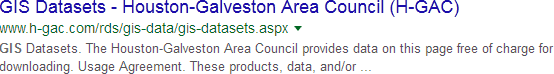
- Using a web browser, search for "h-gac gis" and select the result as shown below or go directly to: http://www.h-gac.com/rds/gis-data/gis-datasets.aspx.
- Under the Dataset Categories section, click the Transportation button to filter the results by subject.
- Under the Datasets section, click Major Roads.
- Click Download Dataset.
- Click the blue Download button.asdf
Houston METRO Downloads
The Houston METRO website provides GIS data for the public transit system in Houston provided by METRO. For this tutorial, you will need the bus stops and bus routes data which is included in the downloadable zip-file containing all of the GIS data available on the site. To obtain this data:
- Using a web browser, search for "houston metro gis" and select the result as shown below or go directly to: https://www.ridemetro.org/Pages/NewsDownloads.aspx.

- Scroll down to the bottom of the webpage until you see the Downloads subheading. Click on Downloads.Scroll down to the bottom of the webpage until you and locate the Zipped Data Files section.
There are two links in this section that look promising: METRO GIS Data Layers and METRO GIS Data. From the perspective of a GIS user, there is nothing about those particular link names that is helpful in deducing which link to download. After testing both downloads, we determined that the Metro GIS Data download contains only the METRO service boundary, while the METRO GIS Data Layers download contains
- Click METRO GIS Data Layers to download. see 4 links at the bottom of the page. Click on METRO GIS Data Layers. The data file should automatically begin downloading.
HCAD
Though it is not used in this course, the Harris County Appraisal District (HCAD) Public Data is another great online source that provides similar data such as highways, utilities, and water districts and is available at: http://pdata.hcad.org/GIS/index.html
The HCAD (Harris County Appraisal District) Public Data is another great online source that provides similar data such as highways, utilities, and water districts and is available at: http://pdata.hcad.org/GIS/index.html
OPTION 2: Accessing tutorial data from Fondren Library using the gistrain profile
If you are completing this tutorial from a computer in Fondren Library and are logged in using the gistrain profile, follow the instructions below:
- From the Start menu, click Computer > gisdata (\\file-rnas.rice.edu) (R:) > Short_Courses > Introduction_to_GIS_Data_Management.
- To create a personal copy of the tutorial data, drag the IntroTutorialData folder onto the Desktop.
- Close all windows.
OPTION 3: Accessing tutorial data online using a personal computer
If you are completing this tutorial from a personal computer, you will need to download the tutorial data online by following the instructions below:
...
Any time throughout the tutorial that you see reference to the file path C:\Users\gistrain\Desktop\IntroTutorialData, you will need to substitute it with the file path you have just selected.
The following step-by-step instructions and screenshots are based on the Windows 7 operating system with the Windows Classic desktop theme and ArcGIS for Desktop 10.1 SP1 software with an Advanced license. If your personal system configuration varies, you may experience minor differences from the instructions and screenshots.
Preparing the Downloaded Data for ArcGIS Pro
Once you have downloaded the Bus Stops and Bus Routes data from Houston METRO and the SuperNeighborhoods and Freeways data from COHGIS, you should be able to find the data files in your Downloads folder. You will see that all the files are zipped, meaning they contain compressed files of data within them (you can tell a file is zipped when the file type column reads “Compressed (zipped) Folder”). You will need to unzip the folders to be able to see the data inside them. To do that:
...
Your data should now be in a file folder in its decompressed format and ready to be brought into ArcMap.
...
ArcGIS Pro.
...
Creating a New Project in ArcGIS Pro
- When ArcGIS Pro opens, under the Create a new project section, click the Blank project template.
- In the 'Create a New Project' window, for Name, type "Intro".
- For Location, click the Browse... button to the right.
- In the 'Select a folder to store the project.' window, click Computer in the left column and click Desktop in the right column and click OK.

- Click OK once again.
- Maximize the ArcGIS Pro application window.
- In the
...