...
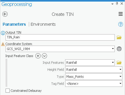
- For ‘Input Features’, use the drop-down menu to select the Rainfall layer.
- For ‘Height Field’, use the drop-down menu to select the Rainfall field.
- Ensure your ‘Create TIN’ window appears as shown below and click Run.
This method interpolates the rainfall data points by defining the vertices of each triangle in the TIN and interpolating across each triangle. From here, it is very simple to convert the TIN to a raster, so that it is in the same format as your other interpolation layers.
...