...
- In the Catalog pane, click the US_tract_1980_Harris_County geodatabase feature class located in the NHGIS folder and drag-and-drop it up into the Intro_Part2.gdb. A progress bar will appear that reads 'Copying...' Once it is complete, you will see a copy of US_tract_1980_Harris_County inside the Intro_Part2.gdb as shown below.

- Repeat the above step to drag-and-dropMajor_Rivers from the Major_Rivers.gdb into the Intro_Part2.gdb.
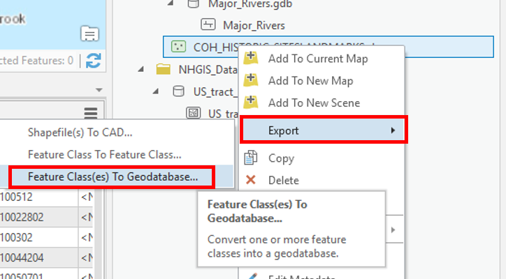
- COH_HISTORIC_SITESLANDMARKS is a Shapefile feature class, so it requires a different method to be imported into the Project Geodatabase. In the Catalog pane, right-click on COH_HISTORIC_SITESLANDMARKS.shp and selectExport > Feature class(es) to geodatabase.
- Accept default settings as shown below and clickRun.

- Right-click on Intro_Part2.gdb and selectRefresh.

- Your Project Geodatabase should now contain three Geodatabase feature classes: COH_HISTORIC_SITESLANDMARKS, Major_Rivers, and US_tract_1980_Harris_County.

- In the Catalog pane, in the Folders section, right-click on Downloads and selectRemove.

...
- Repeat Step 7 to remove the connection to the NHGIS folder.
Bonus: Symbolizing Layers By Attributes
Symbolizing Layers By Quantity
- In the Contents pane, right-click the Census_2010_By_SuperNeighborhood layer name and selectSymbology.
...