...
| Info |
|---|
This guide was created by the staff of the GIS/Data Center at Rice University and is to be used for individual educational purposes only. The steps outlined in this guide require access to ArcGIS Pro software and data that is available both online and at Fondren Library. The following text styles are used throughout the guide: Explanatory text appears in a regular font.
Folder and file names are in italics. Names of Programs, Windows, Panes, Views, or Buttons are Capitalized. 'Names of windows or entry fields are in single quotation marks.' "Text to be typed appears in double quotation marks." |
Getting Started
For more practice navigating the ArcGIS Pro interface, check out our short course: Introduction to ArcGIS Pro
Creating a New Project in ArcGIS Pro
...
- The map takes on the projection of the first data layer added. If a JPG is added first, then the map projection would be undefined (as the projection for a JPG is undefined). To define the map's coordinate system, in the Contents pane on the left, right-click the PlayMapping map GISWorkshop map and navigate to Properties > Coordinate System Systems > Geographic Coordinate Systems > North America > US USA and Territories > NAD 1927.
- Click OK in the Properties window.
- In the Catalog pane, right-click the HST.jpg raster and select Add To Current Map.
- An alternative method of adding data to a map is to click-and-hold the item and drag-and-drop it into the Map View.
...
- In the Contents pane, right-click HST.jpg then click Zoom to Layer.
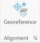
- In the Contents pane, click HST.jpg so that is highlighted in light blue. From the ribbon, click the Imagery tab and then click the Georeference button.
- Click Add Control Points.

- Click the top left corner of the HST JPG.
- Right-click and select Input X and Y...
- Type Type X : -104.5, Y : 33 and and click OK. The x-value is the West coordinate and it is negative because we are in the Western Hemisphere. The y-value is the North coordinate.
- RightIn the Contents pane, right-click HST and click Zoom to Layer.
- Repeat steps 5-8 for the bottom right corner of HST, but type X : -103.5, Y : 32.
- Repeat steps 5-8 for the bottom left corner of HST but type X : -104.5, Y : 32.
- Repeat steps 5-8 for the top right corner but type X : -103.5, Y : 33.
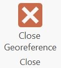
- From the Georeferencing tab, click Save.

- Then click Close Georeference.
- Above the ribbon, on the Quick Access toolbar, click the Save button.
...