...
- Using a web browser, search for "houston metro gis" and select the result as shown below or go directly to: https://www.ridemetro.org/Pages/DigitalAssets.aspx.

- Scroll down to the bottom of the webpage and select Get Started.

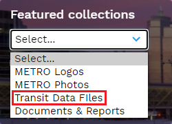
- From the left "Featured collections" dropdown select Transit Data Files.
- Select Shape files.
- Click Bus Routes - shape file (do not check the box) and click the blue Download button.
- Click outside of the download pop-up window to close it.
- Click Bus Stops - shape file (do not check the box) and click the blue Download button.
- At the bottom of your browser window, you should see both the RS2688_Bus Stops - shape file.zip and RS2689_Bus Routes - shape file.zip compressed folders downloaded.

COHGIS
Though it is not used in this course, the COHGIS (City of Houston GIS) Data Hub provides over 200 data sets including administrative boundaries, amenity locations, transportation routes, crime, and flooding and is available at: https://cohgis-mycity.opendata.arcgis.com/. (Whenever you see a URL that ends in opendata.arcgis.com, you will know that you are visiting a standard ArcGIS Hub, which are commonly used by government entities for sharing GIS data.)
HCAD
HCAD
The Harris County Appraisal District (HCAD) Public Data website is another great source of Houston data .HCAD provides similar data such as highways, utilities, and water districts related to land parcels and other boundaries and is available at at: https://hcad.org/hcad-online-services/pdata/.
...