...
- In the Contents pane, right-click the HGAC_tracts layer name and select Data > Export Features.
- In the Geoprocessing pane, click the 'Output Feature Class' field to edit the name. Replace Census_2010_By_SuperNeighbor HGAC_tracts with "MyNeighborhoodMyTract". Ensure that you leave everything in the file path through Intro.gdb\.
...
- On the ribbon, click the Insert tab.
- In the Project group, click the New Map button.
- At the bottom of the Geoprocessing pane, click the Catalog pane tab.
- Rename the map My Neighborhood and Tract and add MyNeighborhoodMyTract, METRO_BusStops and METRO_BusRoutes.
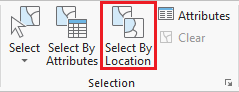
- In the Selection group, click the Select By Location button to open the Select Layer By Location tool in the Geoprocessing pane.
- Select BusStops for the For 'Input Feature Layer'. Select, select METRO_BusStops.
- For 'Relationship', select Within a distance.
- For 'Selection Features', select MyTract.
- For the 'Search Distance' type '50'.
- for the 'Relationship'. SelectMyNeighborhood for the 'Selecting Features'. Type '50' for the 'Search Distance'. Ensure the 'Selection type' is 'New selection'. Ensure your panel looks like the one '.
- Ensure your 'Select Layer By Location' tool settings appear as shown below and click Run.

Do not clear the selection. Repeat Step 6, searching for bus routes within 100 ft of a bus stop in your neighborhood. Select BusRoutes for - For the 'Input Feature Layer', select METRO_BusRoutes.
- For 'Relationship' SelectWithin a distance for the 'Relationship'. Select BusStops for the 'Selecting Features'. Type '100' for the 'Search Distance'. Ensure the 'Selection type' is 'Add to the current selection'. Ensure your panel looks like the one
- Ensure your 'Select Layer By Location' tool settings appear as shown below and click Run.

Your map should now have selected all bus stops within 50 feet of your neighborhood as well as all bus routes that run within 100ft of those bus stops. - In the Contents pane, right-click the the METRO_BusStops layer name and select Data > Export Features.
- In the Geoprocessing pane, click the 'Output Feature Class' field to edit the name. Replace HGAC_BusStops with "MyBusStops". Ensure that you leave everything in the file path through Intro.gdb\.
- In the Contents pane, right-click the the METRO_BusRoutes layer name and select Data > Export Features.
- In the Geoprocessing pane, click the 'Output Feature Class' field to edit the name. ReplaceBusRoutes with "MyBusRoutes". Ensure that you leave everything in the file path through Intro.gdb\.
- In the Contents pane, right-click and remove METRO_BusStops and METRO_BusRoutes. You should now have three layers in your Contents pane, UniversityPlace MyTract, MyBusStops, and MyBusRoutes.
...