...
- Use the primary 'Symbology' drop-down menu to select Unique Values.Use the
- For 'Field 1' drop-down menu to select Name', select GEOID10, which contains a unique ID, called a FIPS code, for every census tract.
- When asked 'Do you you want to generate the full list of unique values?', click Yes.
- In the Contents pane, collapse the HGAC_tracts symbology.
Selecting Features Programatically
Selecting Features By Attributes
Sometimes you want to automatically select numerous features in a layer based on certain tabular criteria. In this case, you will select all the census tracts in Harris County out of the larger 13-county region. The COUNTYPF10 field in the attribute table contains the county FIPS code, which is '201' for Harris County.
Selecting Features By Attributes
- In the ribbon, click the In the ribbon, click the Map tab.
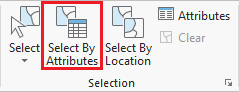
- In the Selection group, click the Select By Attributes button to open the Select Layer By Attribute tool in the Geoprocessing pane.
- In the Geoprocessing pane , click the Add Clause on the right, ensure 'Input Rows' says HarrisTracts. This layer was selected automatically, because it was selected in the Contents pane at the time you clicked the tool button.
- Click the New selection button.
- Use the drop-down menus to build the following expression: Name (COUNTYFP10 is Equal equal to 'UNIVERSITY PLACE' and click the Add button.201').
- At the bottom of the Geoprocessing pane, click RunClick Apply.
Exporting Selected Features
- In the Contents pane, right-click the HGAC_tracts layer name and select Data > Export Features.
- In the Geoprocessing pane, click the for 'Output Feature Class' field to edit the name. Replace HGAC_tracts with "MyTract". Ensure type "HarrisTracts". If the full file path is shown, ensure that you leave everything in the file path through Intro.gdb\.
- At the bottom of the Geoprocessing pane, click Run.
- To see the results, in the Contents pane, right-click the newly exported HarrisTracts layer name and select Zoom To Layer.
- In the Contents pane, right-click the original HGAC_tracts layer and select Remove. Note that this process does not delete the layer from you project geodatabase, but only removes the layer from this particular Census Tracts map.
Now you will repeat the above process to select the census tract for Rice University.
- In the 'Selecting Features By Attributes' section above, repeat steps 2-5 with the expression: (GEOID10 is equal to 4820141200). You can type in the FIPS code to have it highlighted in the drop-down list rather than scrolling through the entire list to locate it.
- In the 'Exporting Selected Features' section above, repeat steps 2-5 with the e
Selecting Features By Location
...