...
The best option for getting the full GIS project experience is to download data from online GIS data portals. You will also gain exposure to the best GIS data websites for the Houston region. For this exercise, we will be looking at rivers and wastewater outfalls in Houston's Super Neighborhoods.
Downloading
...
Source Data from GDC
Super Neighborhood Dataset
Click the following link to obtain the Super Neighborhood dataset: SuperNeighborhoods2010Census.zip
Downloading Data from Source Websites
H-GAC GIS Dataset
The Houston-Galveston Area Council (H-GAC) is the 13-county Metropolitan Planning Organization (MPO) for the Houston region. Federal legislation requires that an MPO be designated for each urbanized area with a population greater than 50,000 people (as established by the U.S. Census Bureau) in order to conduct long-range metropolitan transportation planning and be eligible for Federal funding for transportation projects. Their mission to carry out metropolitan transportation planning means that MPOs are a great source of data on topics such as demographics, employment, land use, transportation, and environmental conditions and most of these topics are well-suited towards GIS analysis.
Most of the data provided on the H-GAC portal is not originally created by the H-GAC, but rather is either aggregated from multiple municipalities up to the 13-country region, or clipped from the country or state down to the 13-county region.
- Using a web browser, search for "h-gac gis" and select the result as shown below
...
COHGIS Open Data Portal
The COHGIS (City of Houston GIS) Open Data Portal website provides over 100 data sets including administrative boundaries, amenity locations, transportation routes, crime, and flooding. For this tutorial, we will download population and housing data from the 2010 census, which has been aggregated to super neighborhood boundaries.
- Using a web browser, search for "houston gis data" and select the result as shown below or or go directly to: https://cohgisgishub-h-mycitygac.opendatahub.arcgis.com/.

Whenever you see a URL that ends in opendata.arcgis.com, you will know that you are visiting a standard ArcGIS Open Data portal.
...
In this case, we are looking for census data by super neighborhood. To learn more about super neighborhoods, visit the City of Houston Super Neighbhorhoods webpage.
...
H-GAC GIS Datasets
The Houston-Galveston Area Council (H-GAC) is the 13-county Metropolitan Planning Organization (MPO) for the Houston region. Federal legislation requires that an MPO be designated for each urbanized area with a population greater than 50,000 people (as established by the U.S. Census Bureau) in order to conduct long-range metropolitan transportation planning and be eligible for Federal funding for transportation projects. Their mission to carry out metropolitan transportation planning means that MPOs are a great source of data on topics such as demographics, employment, land use, transportation, and environmental conditions and most of these topics are well-suited towards GIS analysis.
Most of the data provided on the H-GAC portal is not originally created by the H-GAC, but rather is either aggregated from multiple municipalities up to the 13-country region, or clipped from the country or state down to the 13-county region.
...

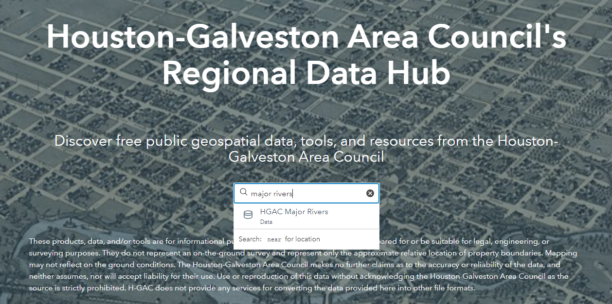
- In the "Search data" box, type in "Major Rivers" without pressing "Enter".
- The option "HGAC Major Rivers" should pop up - click on this option.
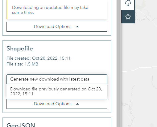
- Now, we can see the rivers depicted on a map in the Houston-Galveston area. We want to access this data in the form of a shapefile. To do this, click the "Download" button on the left side of the screen, as shown below.

- Scroll down on the left pane to the "Shapefile" tab. Click "Download Options" followed by "Download file previously generated on ...". A zip file titled "HGAC_Major_Rivers.zip" should be downloaded.
H-GAC GIS Dataset
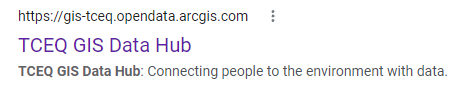
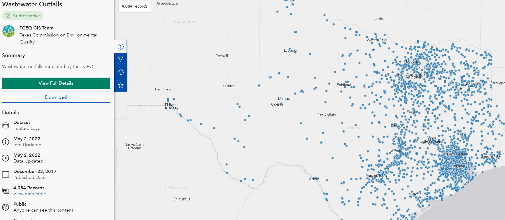
- Using a web browser, search for "tceq gis data hub", and click on the link shown below. Alternatively, go directly to their website here: https://gis-tceq.opendata.arcgis.com/
- In the "Search data" box, type in "Wastewater" without pressing "Enter".

- The option "Wastewater Outfalls" should pop up - click on this option.

- Now, we can see the wastewater outfalls in Texas depicted on a map. We want to access this data in the form of a shapefile. To do this, we follow the same download procedures as with the "Major Rivers" dataset, which should result in a zip file titled "Wastewater_Outfalls.zip".
...
HCAD
Though it is not used in this course, the Harris County Appraisal District (HCAD) Public Data is another great online source that provides similar data such as highways, utilities, and water districts and is available at: http://pdata.hcad.org/GIS/index.html
...
- On the Desktop, click the File Explorer icon located on the Windows Taskbar on the bottom left corner of the screen.
- In the left column, click My Computer. In the right column, double-click C:/ > Users > gis.ADRICE > Downloads. Ensure that you see the following zipped folders in your Downloads folder.
- SuperNeighborhoods2010Census
- Census_2010_By_SuperNeighborhood
- HGAC_Major_Rivers
- Wastewater_Outfalls
- Select all three folders.
- Right-click any of the selected folders and select 7-Zip > Extract Here. Your data is in a file folder in its decompressed format and ready to be brought into ArcGIS Pro.
...
- From the Start menu, launch ArcGIS Pro.
- When ArcGIS Pro opens, under the Create a new project section, click the Blank project template.
- In the 'Create a New Project' window, for Name, type "CEVE101".
- For Location, click the Browse... button to the right.
- In the 'Select a folder to store the project.' window, click Computer in the left column and click Desktop in the right column and click OK.
 the desired location for GIS projects on your computer and click OK.
 - ClickOK once again.
- Maximize the ArcGIS Pro application window.
...
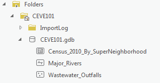
- In the Catalog pane on the right, expand Folders > CEVE101 > CEVE101.gdb. There are currently no data in this folder.
- Right-click Folders and select Add Folder Connection.
- In the left column click Computer. in the right column double click C: > Users > gistrain(your user). Single click Downloads and select OK.
- In the Catalog pane, expand Downloads.
- Fully expand all folders and geodatabases in the Downloads folder.
- Drag and drop the Major_Rivers feature class into the CEVE101.gdb
- Repeat drag and drop for Wastewater_Outfalls
- Right-click the CEVE101.gdb and select Import > Feature Class

- Click the Browse button to navigate to input features. In the left column click Folders. In the right column click Downloads > Census_2010_By_SuperNeighborhood. Single click Census_2010_By_SuperNeighborhood.shp SuperNeighborhoods2010Census > SuperNeighborhoods2010Census > CEVE101.shp .
- Type "Census_2010_By_SuperNeighborhood" into the Output Feature Class bar.
- Click Run.
- In the Catalog pane, expand the CEVE101.gdb. There are now three feature classes contained within: Major_Rivers, Census_2010_By_SuperNeighborhood, Wastewater_Outfalls
- Right-click on the Downloads folder. Select Remove.
...