...
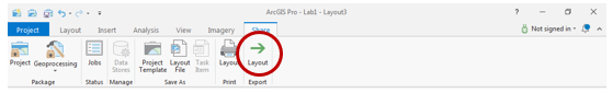
- Select Share Tab and click Export Layout.
- Save your map document.
FOR MAP LAYOUT TO BE TURNED IN
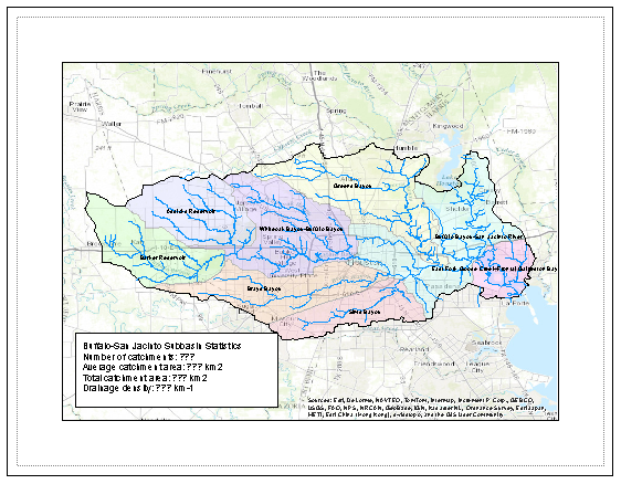
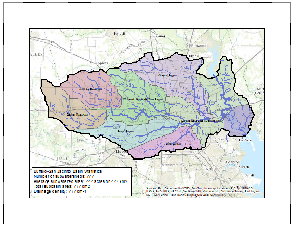
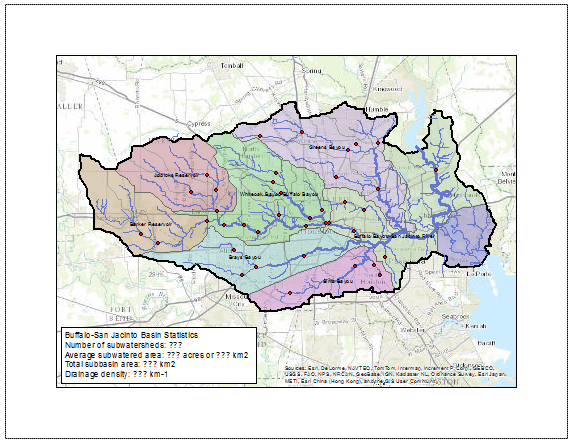
Create an 8.5 x 11 layout clearly deliniating the subbasin and watersheds on top of a basemap, with the symbology and labels corresponding to the watersheds. You may need to further adjust the order of your layers in the Table of Contents and their symbology.

Part 3: Mapping Flowline Data
...
You can edit the text and customize the rectangle appearance by double-clicking on the rectangle text element.
- Save your map document.
FOR MAP LAYOUT TO BE TURNED IN
Add a text box to the layout containing the answers to the following questions:
...
4) What is the ratio of the total length of the streamlines to the total area of the Buffalo-San Jacinto catchments (called the drainage density) in km-1?
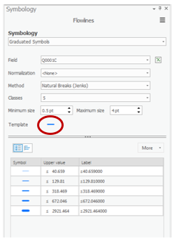
Symbolizing features by quantities using graduated symbols
- Open the Flowlines Symbology tab.
- Use Symbology drop down menu to select Graduated symbols.
- Use the ‘Field’ drop-down menu to select the Q0001C field, which contains the mean annual flow.
- Click the line next to Template to change the symbology of your flowlines.
- Save your map document.
...
FOR MAP LAYOUT TO BE TURNED IN
The flowlines should have graduated symbology based on their mean annual flow.
Part 4: Mapping Stream Gauge Data
...
- Export the selected StreamGage features into your HydrologyLab geodatabase and name the new feature class “SubbasinStreamGages”.
- Remove the original StreamGage layer from the Table of Contents.
- Save your map document.
- When you are finished creating your layout, close ArcGIS Pro.
FOR MAP LAYOUT TO BE TURNED IN
The stream gage site locations should be added to the map layout.
Part 5: Mapping Soils Data
...
As before, create a map layout and add the statistics using a rectangle text element.
TO BE TURNED IN: An 8.5 x 11 map document showing the soils clipped to the Buffalo-San Jacinto subbasin and a text box containing the answers to the following questions:
...
- To export both your Lab1Hydrology and Lab1Soils map documents, open each of them in turn and click the Share menu and select Export Layout….
- Navigate to your HydrologyLab folder.
- Use the ‘Save as type:’ drop-down menu to select PDF.
- Click Export.
- Print both map PDFs to turn in
Deliverables
- Create an 8.5 x 11 layout with the following layers limited to the subbasin:
...
2) Based on your previous calculation of the area of the subbasin in km2, what volume of water (km3) could potentially be stored in the top 1 m of soil in the Buffalo-San Jacinto subbasin if the soil were fully saturated with water?