...
- Using Windows Explorer, navigate to the location where you would like to locate your project folder (likely the E: or F: drive).
- Create a new folder inside your selected location and name it “HydrologyLab”“HydrologyLab”. Remember not to use any spaces. Note the full file path of your HydrologyLab folder.
...
- On the Desktop, click the Start menu and select All Programs à ArcGIS à ArcGIS Pro à -> ArcGIS -> ArcGIS Pro.
- On the Log-In window, click Configure Your Licensing Options.

- In the ‘Licensing’ window, select Single Use License for License Type, as shown on the following page, once it finishes loading and click OK.

- In the ‘ArcGIS Pro’ window, select Blank.

- In the ‘Create a New Project’ window, type HydrologyLab as Name and click the icon to navigate to the HydrologyLab folder created. Uncheck Create a new folder for this project. Click OK.

- In the Insert tab, click ‘New Map’.

- On Contents pane, clickMap name to rename it from Map to Lab1.

Part 2: Mapping Watershed Data
...
- In a web browser, go to www.arcgis.com.
- In the search box in the top right of the website, type “NFIE-Geo Regions”.
- Click to Open the NFIE-Geo Regions web map.
- On the map, click to select the Texas-Gulf region, which encompasses Houston.
- Click More info.
- In the Content section, right-click the NFIEGeo_12.gdb.zip file and select Download.

- Navigate to the location where the zipped file has been downloaded.
- Right-click the downloaded NFIEGeo_12.gdb.zip file and select Extract All….
- In the ‘Extract Compressed (Zipped) Folders window, click Extract.
- In the new extracted folder window that opens, right-click the extracted NFIEGeo_12.gdb folder and select and Copy.
- Navigate back to your HydrologyLab folder.
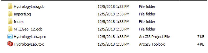
- Paste the NFIEGeo_12.gdb folder directly inside your HydrologyLab folder. Do NOT paste them inside the Hydrologylab.gdb geodatabase.
- Ensure that your HydrologyLab folder appears as shown below.
- Return to ArcGIS Pro.
...
- On the Standard toolbar, click the Basemap button.

- In the ‘Basemap’ window, select the Topographic basemap.
...
- In the Table of Contents, click and select the Subwatershed layer. Click Appearance Tab.
![]()
- Under effects, type “60” to change the transparency of the layer.
...