...
- At the top of the Geoprocessing pane, click the Back arrow button.
- Within the Analyzing Patterns toolset, click the Incremental Spatial Autocorrelation tool.
- In the upper right corner of the ‘Incremental Spatial Autocorrelation’ tool, hover over the Help ? button.
(Help)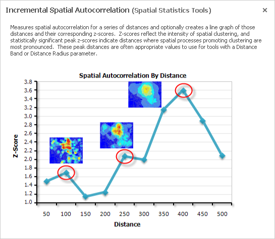
The Incremental Spatial Autocorrelation tool iterates the Spatial Autocorrelation tool using multiple distance bands and plots the corresponding z-scores at each distance. The result is a chart showing you the peak z-scores at distances where spatial clustering is most pronounced.
...
- At the top of the Geoprocessing pane, click the Back arrow button.
- Within the Analyzing Patterns toolset, click the High/Low Clustering (Getis-Ord General G) tool.
- In the upper right corner of the ‘High/Low Clustering’ tool, hover over the Help ? button.
(Help)
asdf
Percent Commuting Alone By Car
...