...
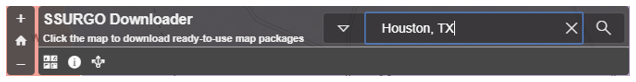
- On the top right search bar, search for SSURGO Downloader.

- Scroll down and click the result SSURGO Downloader.

- On the right hand side of the page click View Application.

- In the search bar in the top right corner, type Houston, TX.
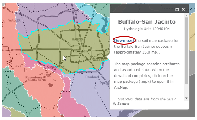
- Click in the Buffalo-San Jacinto subbasin to select it and click the Download link.
- Right-click on your downloaded BuffaloSanJacinto_12040104.mpk file and select Show in folder. Copy its file path location.
- Open ArcGIS Pro, click Insert tab and select Import Map.

- Paste the file path location to import window. Press Enter. Select BuffaloSanJacinto_12040104.mpk file.
- Click OK.

A map package (.mpk), contains both a map document (.mxd) and all data layers referenced by that map document. A new instance of ArcMap will open showing the different soil classes within the subbasin.
...
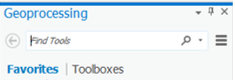
- On the Map tab, click the Analysis tab and select the Tools.
- On the search bar, type Clip and press Enter. Click Clip (Analysis Tools).
Read the ‘Clip’ window help and review the sample illustration. Notice that this tool clips one dataset to the extent, or shape, of another dataset.
...
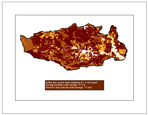
- What is the average available water storage (cm) in the Buffalo-San Jacinto subbasin?
- Based on your previous calculation of the area of the subbasin in km2, what volume of water (km3) could potentially be stored in the top 1 m of soil in the Buffalo-San Jacinto subbasin if the soil were fully saturated with water?
Exporting map documents
- To export both your Lab1Hydrology and Lab1Soils map documents, open each of them in turn and click the Project menu and select Export Map….
- Navigate to your HydrologyLab folder.
- Use the ‘Save as type:’ drop-down menu to select PDF.
- Click Save.
- Print both map PDFs to turn in.
Deliverables
- Create an 8.5 x 11 layout with the following layers limited to the subbasin:
...
- Subbasin – hollow outline
- Watersheds – categorical symbology and labeled
- Flowlines – graduated symbology
- Stream gages – point symbol
- Basemap
Include a text box in the layout containing the answers to the following questions:
1) How many HUC-12 catchments are there in the Buffalo-San Jacinto Basin?
2) What is their average area in km2?
3) What is the total area of this subbasin in km2?
4) What is the ratio of the length of the streamlines to the area of the Buffalo-San Jacinto subbasin (called the drainage density) in km-1?
2. Create an 8.5 x 11 layout with the following layers limited to the subbasin:
- Subbasin – hollow outline
- Soils – graduated colors
Include a text box in the layout containing the answers to the following questions:
1) What is the average available water storage (cm) in the Buffalo-San Jacinto subbasin?
2) Based on your previous calculation of the area of the subbasin in km2, what volume of water (km3) could potentially be stored in the top 1 m of soil in the Buffalo-San Jacinto subbasin if the soil were fully saturated with water?
[g1]I changed this back to Subbasin from the previous version of the lab, instead of boundary