...
- In the Contents pane on the left, double-click the MajorRoads layer name to open the 'Layer Properties' window.
- On the left, click the Source tab.
- Scroll down and expand the Spatial Reference section.
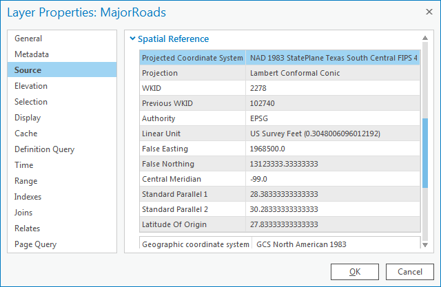
Under the ‘Spatial Reference’ section, scroll down and notice that both a geographic coordinate system and a projection are listed, which indicates that the coordinate system of this feature class has already been defined.
...
The geographic coordinate system and projection for each of the three feature classes you investigated are summarized in the table below.
Layer | Geographic Coordinate System | Projected Coordinate System |
MajorRoads | NAD 1983 | State Plane Texas South Central |
| Schools | NAD 1983 | Texas Centric Mapping System |
County | Undefined | Undefined |
...
- Use the 'Display units' drop-down menu to select US Feet and click OK.
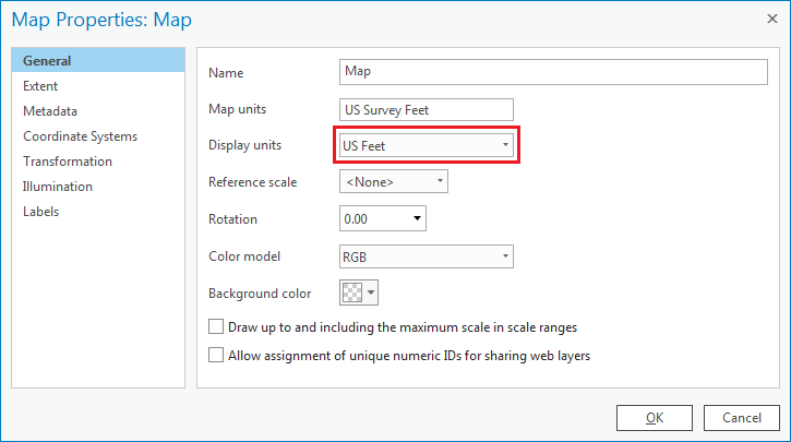
Now, notice when you move your cursor around the map, the coordinates listed in the bottom of the map view are similar to those shown below, indicating the location of Houston in the State Plane coordinate system with units of millions of feet.
...
Of the three feature classes you examined, the County feature class was the only one that was undefined. Since the spatial reference information cannot be located using ArcGIS, you must turn to the source of the data itself. The data was originally downloaded from the following website: http://www.esri.com/data/download/census2000-tigerline, which is no longer available. A screenshot of the metadata provided on that website appears below.
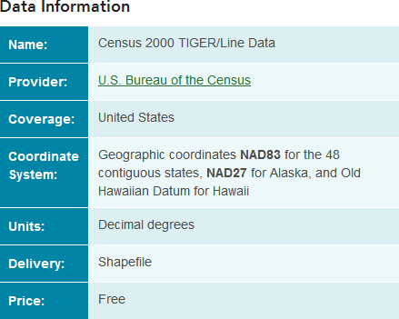
The metadata indicates that you must define the geographic coordinate system for the layer as NAD83, or North American Datum 1983. Fortunately, this is the same geographic coordinate system used by the other two layers. Since no projection is listed, you can assume that the layer has not been projected and was created in a geographic coordinate system only. The fact that the units are listed as decimal degrees further confirms this assumption.
...
The State Plane Texas South Central projection has been selected for the final map projection. All layers that are not currently in that projection will need to be re-projected, such as the County and Schools feature classes. All layers that are already in the final projection can be left as is and do not need to be re-projected, such as the MajorRoads feature class.
Layer | Geographic Coordinate System | Projected Coordinate System | Matches Final Projection? |
MajorRoads | NAD 1983 | State Plane Texas South Central | Yes |
| Schools | NAD 1983 | Texas Centric Mapping System | No |
County | NAD 1983 | None | No |
...
- Repeat all steps in the 'Projecting Layers' section with the Schools layer. When your Geoprocessing pane appears as shown below, select Run.

All of your layers have now been projected into the State Plane Texas South Central projection.
...