| Name
|
Size
|
Creator |
Creation Date
|
Last Modification Date
|
Labels |
Attached To |
|
PNG File CopyFormulaDown.png |
2 kB |
Jean Aroom |
Mar 04, 2019 10:26 |
Mar 04, 2019 10:26 |
|
Page: Mapping Tabular Data
|
|
PNG File image2019-3-4 11:10:23.png |
679 kB |
Jean Aroom |
Mar 04, 2019 10:10 |
Mar 04, 2019 10:10 |
|
Page: Mapping Tabular Data
|
|
PNG File LandUseSymbology.png |
5 kB |
Jean Aroom |
Mar 04, 2019 10:09 |
Mar 04, 2019 10:09 |
|
Page: Mapping Tabular Data
|
|
PNG File ColorSelection.png |
4 kB |
Jean Aroom |
Mar 04, 2019 10:09 |
Mar 04, 2019 10:09 |
|
Page: Mapping Tabular Data
|
|
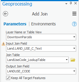
PNG File JoinLookupTable.png |
13 kB |
Jean Aroom |
Mar 04, 2019 08:36 |
Mar 04, 2019 08:36 |
|
Page: Mapping Tabular Data
|
|
PNG File HamburgerButton.png |
12 kB |
Jean Aroom |
Mar 04, 2019 08:26 |
Mar 04, 2019 08:26 |
|
Page: Mapping Tabular Data
|
|
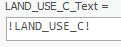
PNG File FieldCalculator.png |
2 kB |
Jean Aroom |
Mar 04, 2019 00:45 |
Mar 04, 2019 00:45 |
|
Page: Mapping Tabular Data
|
|
ZIP Archive Tabular.zip |
4.27 MB |
Jean Aroom |
Mar 03, 2019 23:04 |
Mar 03, 2019 23:04 |
|
Page: Mapping Tabular Data
|
|
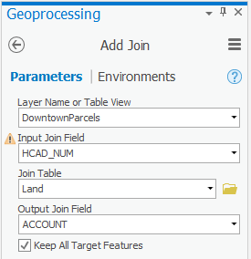
PNG File JoinLandTable.png |
12 kB |
Jean Aroom |
Mar 03, 2019 21:22 |
Mar 03, 2019 21:22 |
|
Page: Mapping Tabular Data
|
|
PNG File ProjectSchools.png |
11 kB |
Jean Aroom |
Feb 28, 2019 13:30 |
Feb 28, 2019 13:30 |
|
Page: Introduction to Coordinate Systems and Projections
|
|
PNG File ProjectCounty.png |
12 kB |
Jean Aroom |
Feb 28, 2019 13:24 |
Feb 28, 2019 13:24 |
|
Page: Introduction to Coordinate Systems and Projections
|
|
PNG File DefineProjectionCounty.png |
8 kB |
Jean Aroom |
Feb 28, 2019 13:12 |
Feb 28, 2019 13:12 |
|
Page: Introduction to Coordinate Systems and Projections
|
|
PNG File MapCoordinatesCountyFt.png |
1 kB |
Jean Aroom |
Feb 28, 2019 10:31 |
Feb 28, 2019 10:31 |
|
Page: Introduction to Coordinate Systems and Projections
|
|
PNG File MapCoordinatesHoustonFt.png |
1 kB |
Jean Aroom |
Feb 28, 2019 09:06 |
Feb 28, 2019 09:06 |
|
Page: Introduction to Coordinate Systems and Projections
|
|
PNG File MapCoordinatesHoustonDD.png |
1 kB |
Jean Aroom |
Feb 28, 2019 08:53 |
Feb 28, 2019 08:53 |
|
Page: Introduction to Coordinate Systems and Projections
|
|
PNG File MapCoordinateSystem.png |
23 kB |
Jean Aroom |
Feb 28, 2019 08:44 |
Feb 28, 2019 08:44 |
|
Page: Introduction to Coordinate Systems and Projections
|
|
PNG File CloseCatalogView.png |
7 kB |
Jean Aroom |
Feb 28, 2019 07:48 |
Feb 28, 2019 07:48 |
|
Page: Introduction to Coordinate Systems and Projections
|
|
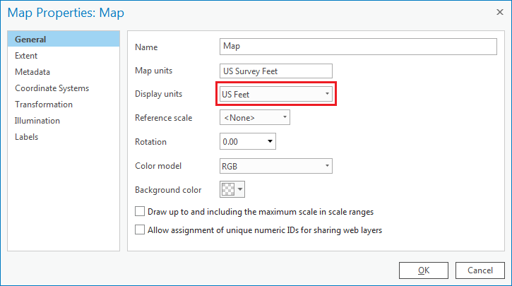
PNG File MapDisplayUnits.png |
13 kB |
Jean Aroom |
Feb 27, 2019 23:35 |
Feb 27, 2019 23:35 |
|
Page: Introduction to Coordinate Systems and Projections
|
|
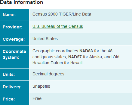
PNG File CountyWebsiteMetadata.png |
17 kB |
Jean Aroom |
Feb 27, 2019 21:57 |
Feb 27, 2019 21:57 |
|
Page: Introduction to Coordinate Systems and Projections
|
|
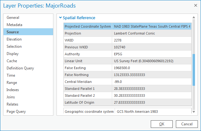
PNG File MajorRoadsSpatialReference.png |
21 kB |
Jean Aroom |
Feb 27, 2019 21:53 |
Feb 27, 2019 21:53 |
|
Page: Introduction to Coordinate Systems and Projections
|